Where Art Meets Science
Scientific visualisations often can look just like objects of visual art. The previous installation of this series, there were topographical surveys visualised on both our moon and Jupiter’s moon. This time, we are focusing on our own Pale Blue Dot.
These maps are not only utilitarian and functional, they are works of art in their own right.
The World’s First Geological Map
Created by William Smith in 1815, this was the map that changed the world and set in motion a century of scientific exploration. Smith’s efforts are remarkable for the time because Smith was not a gent from the upper class, but came from a respectable farming family. As a result of this snobbery, Smith’s map was largely ignored and subsequently plaigiarised. Smith spent a year or so in a debtor’s prison due to his lack of funds. It was only later on in life that his gorgeous map got the recognition it deserved, and Smith became the grandfather of map-making and geological surveys.
Smith’s map is remarkably accurate when compared to modern geological surveys that make use of all sorts of technology. All Smith had at the time was crude surveying equipment. He traveled around the UK while unemployed looking at strata, and then hand-drew and hand-coloured the incredibly intricate and beautiful map. Smith is credited with kicking off other areas of scientific discovery. His young apprentice John Philips went on to found a movement in geology and paleontology and the table of geological eras used today. Smith’s work also became a foundation work influencing Charles Darwin. His story is immortalised in the great book ‘The Map That Changed The World‘ by Simon Winchester.
Click to view larger image

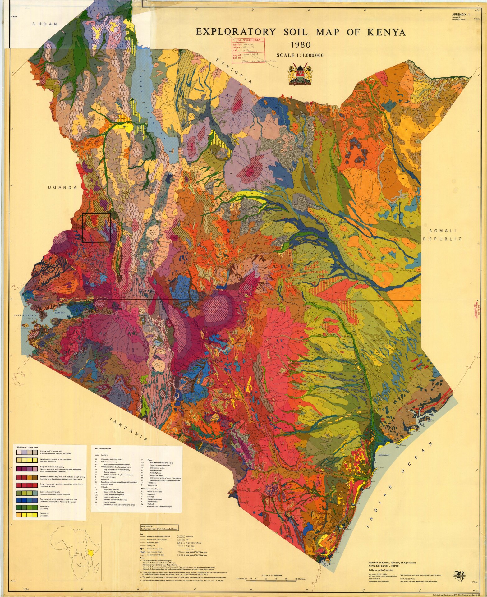
Exploratory Soil Map of Kenya (1980)
Those colours remind me of a beautiful abstract painting. This topographical map has the most aesthetic beauty and would be perfect blown up and framed in a lounge room or perhaps as a screensaver. Of course, it is important to remember that Africa’s land and resources have always been taken without express permission from local people. The land dominated and plundered without end and the original inhabitants of the land left dispossessed and not any wealthier by this external colonisation and exploitation.
Click to view larger image

Alluvial Map of the Lower Mississippi River (1944)
Created by Harold Fisk in 1944 the map exhaustively covered the complex channels, tributaries and morphology. More importantly, it’s incredibly beautiful in a baroque, rococco and arabesque kind of way!
Click to view larger image

Ed Fairburn: Map of the Lake District
Ed Fairburn’s art is where cartography meets portraiture and creates magic. See more of Ed’s amazing work here.
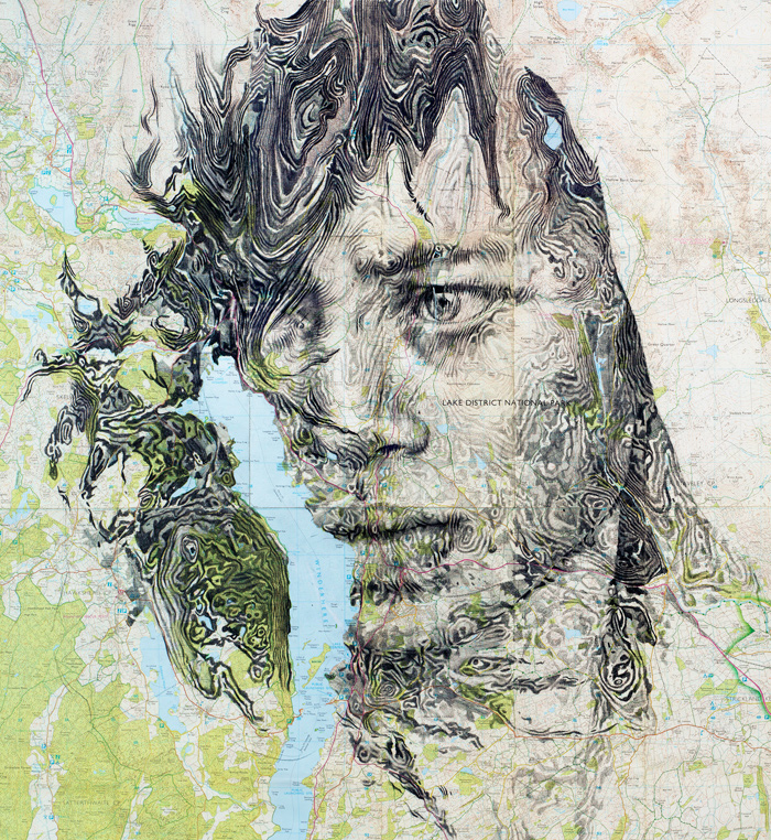
Image Source: Courtesy of Ed Fairburn

Image Source: Courtesy of Ed Fairburn
Find out more about Fairburn’s work here.
Atlantic Ocean Floor: Plate Techtonics Map
With the advent of echo sounding in the mid-20th century, it made mapping the ocean floor possible. This meant that scientists could make maps like this one in the 1960’s.

Read more
Ed Fairburn: Cartographic Artist With Soul
Infoaesthetics: Stunning Art or Infographic? Both

This is a superb follow-up to Map Porn Part 1; both educational and entertaining! Thanks for sharing the Ed Fairburn images and link. I visited his site and was amazed at his incorporation of portraiture and maps.
Very Best Regards,
Eric
LikeLiked by 1 person
Thank you Eric much appreciated. Weirdly enough I sometimes don’t get comment notifications on here so sorry it’s taken ages to reply. Better late than never though I suppose.
LikeLike
These maps are delicious. But the Kenya one grabs my heart. Splendid renditions of the planet’s skin and innards.
LikeLiked by 1 person
Hi Tish thank you for the comment, so glad you enjoyed my article. I haven’t been to Kenya have you? These colours are just amazing and i heard that in real life Kenya is quite a wild and colourful place. The innards of the planet is the perfect term for it. Geology is also a much underestimated discipline
LikeLiked by 1 person
Kenya certainly has some of the most active geology in the world. I gather the Rift is moving apart as we ‘speak’. I’ve just posted a photo which makes this all rather hard to believe.
LikeLiked by 1 person
I love that poem Tish!
LikeLiked by 2 people
As a geo who spent much of five years messing around Mongolia making maps with the aid of a GPS – I was stunned by how Soviet geos, back in the 80s, without any such equipment, had already done it. Found all the hidden spots, and mapped them accurately.
LikeLiked by 2 people
Reblogged this on Ned Hamson's Second Line View of the News.
LikeLiked by 2 people
All the colors! These are so gorgeous
LikeLiked by 2 people