When it comes to design – the Victorians did it better. Nothing quite matches these 19th Century comparative river and mountain maps for exquisite hand-drawn detail, meticulous scale and luminous beauty. It makes me wonder, how can anyone not love old maps?

A New Cartographic Convention
One of the forerunners for this kind of map is a comparative map of mountains by Thomson in 1817.
This was closely followed by William Home Lizar’s ‘A Comparative view of the principle rivers of Scotland’in 1822, one of the first comparative river charts of its kind. Click to see the larger image

Moving Mountains and Rivers
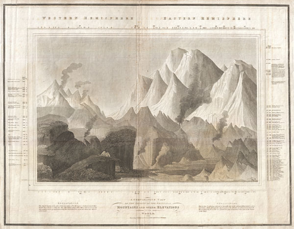
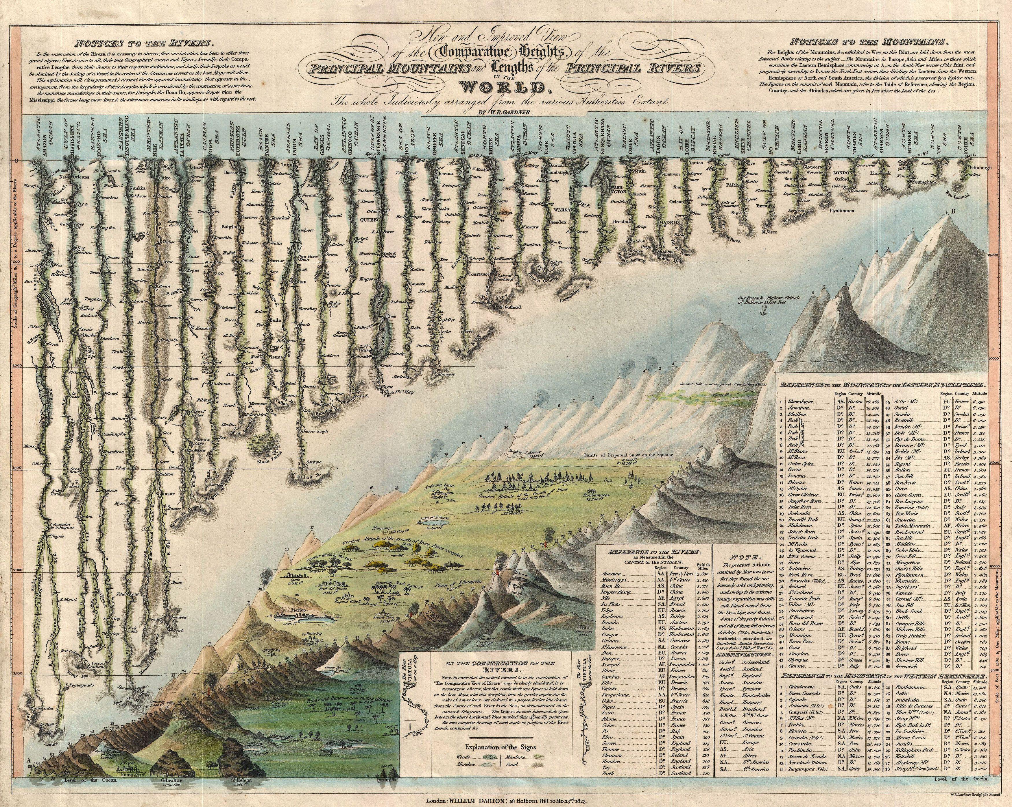
Darton & Gardner’s 1823 Mountains and Rivers chart brings together two in spectacular fashion. Another notable addition is William Darton’s 1823 “New and Improved View of the Comparative Heights of the Principal Mountains and Lengths of the Principal Rivers In The World”. Click to see the larger image
Pièce de Résistance
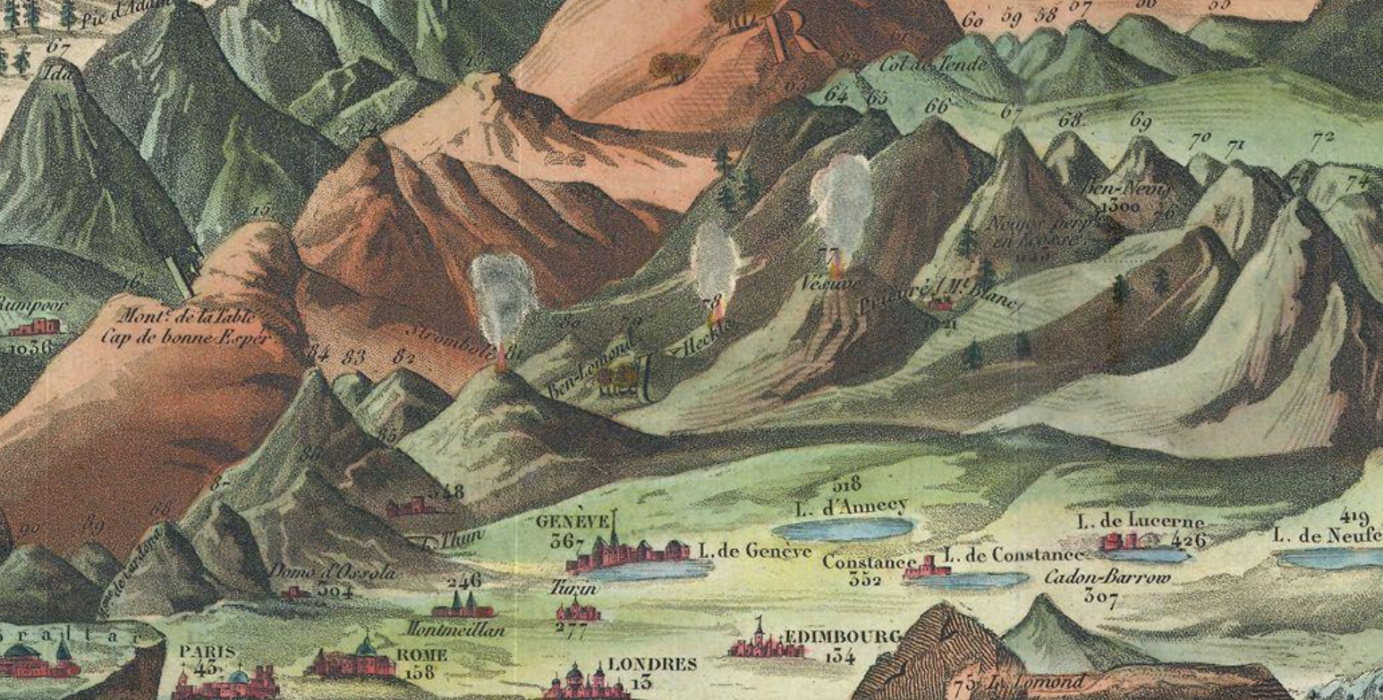
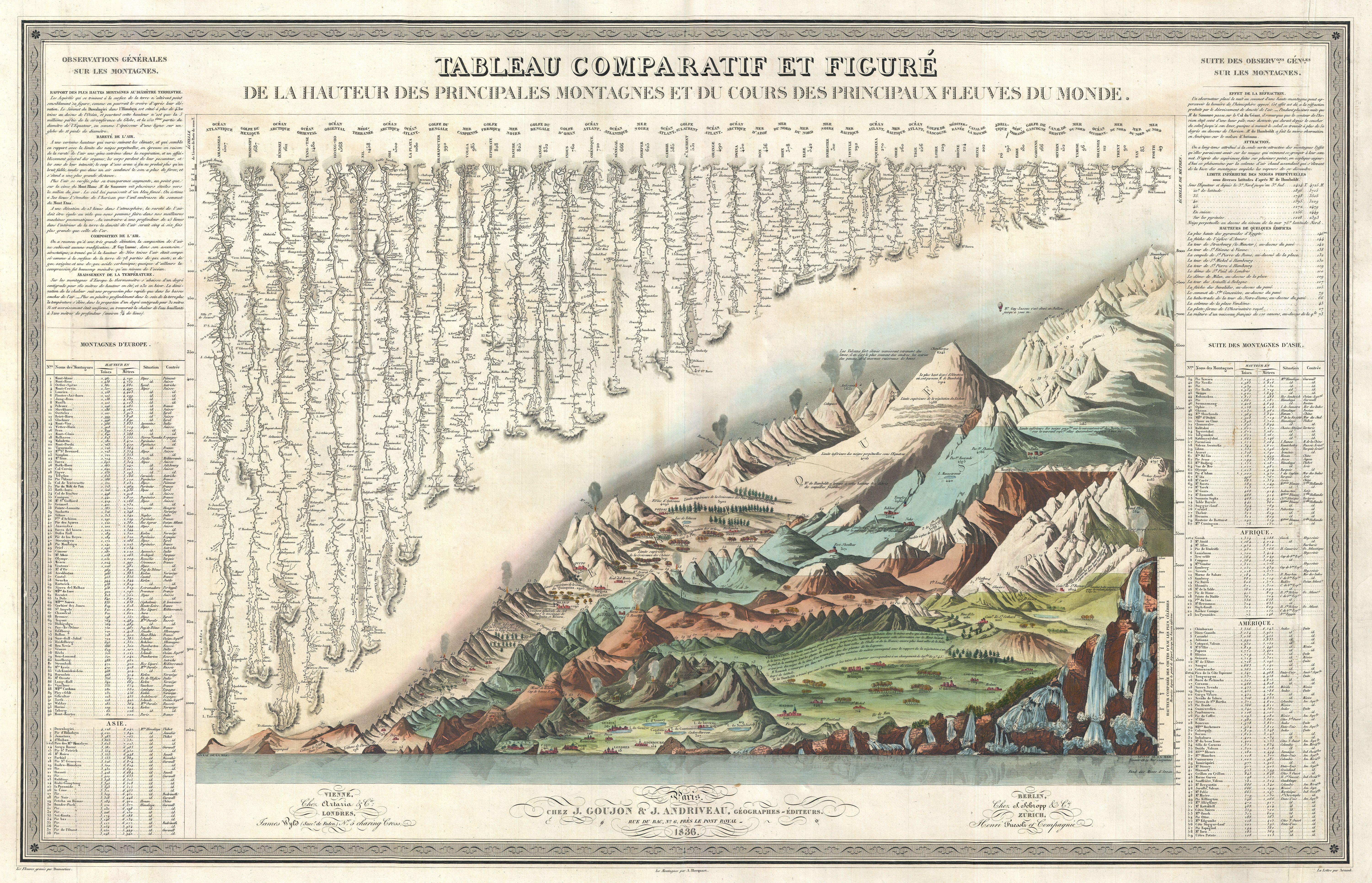
The grandest comparative map of them all has to be the Andriveau & Goujon Comparative Mountains and Rivers Chart. This is where comparative mapping reaches its zenith. On one gigantic sheet, Andriveau & Goujon not only compare and contrast the heights of mountains and the lengths of rivers, but also add a table of waterfalls, show volcanic activity, levels of plant growth and tree lines, and add select cities and European buildings. They even incorporates the achievements of the balloonist Gay-Lussac who ascended to 7000 meters in 1804. Click to see the larger image
Nowadays you can find these works of art used as iPhone and iPad covers.

I’ve always been fascinated by rivers, especially the world’s longest rivers. I love tracing them from their source (usually mountain ranges) to the sea
LikeLiked by 1 person
Me too and it’s such a nostalgic format with the drawing rendered in this way, they don’t make them like this anymore. I love tracing them from their source on maps too, they look so beautiful and bring to mind the way rain travels down a window 🙂
LikeLiked by 1 person
Reblogged this on Windows into History (Reblogs and News) and commented:
Suggested reading – a look at some stunning old maps. Reblogged on Windows into History.
LikeLike
wow this is so interesting! i love looking at old maps like these 🙂 thanks for sharing!
LikeLiked by 1 person
HI Neha thanks for popping by I am so glad you liked them, me too. I found them on a tumblr map blog and there was no explanatory information so I had to go hunting for this, so fascinating the layout, almost surreal art in some ways 🙂
LikeLiked by 1 person
it is and we don’t see these often any more
LikeLiked by 1 person
I agree 🙂
LikeLiked by 1 person
oh gosh wow… these are amazing 🙂 thank you
Nx
LikeLike
good to hear from you angel
Nx
LikeLiked by 1 person
Always lovely to hear from you too sweetie, I hope you have a wonderful weekend
LikeLike
Those comparative river maps are the BEST! Coincidentally, I was just checking out a bunch of Edo-era (17th-19th century) Japanese maps, and they too are detailed as heck, with all kinds of non-essential but fascinating extras.
LikeLike
You should do a post about these Edo maps Jonelle I would love to learn more about it, non-essential random facts make it even better 🙂
LikeLike